Pittsburgh’s Martin Luther King Jr. East Busway is a distinctly local specimen of infrastructure, and a true urban curiosity. The 9.1 mile stretch lies in a hollow, next to the railroad.
The East Busway, now 30 years old, was the first buses only roadway in the U.S., and a pioneer in the Bus Rapid Transit movement. To travel the whole route—downtown to Swissvale—takes a mere 20 minutes; at rush hour buses run every two minutes. The sights go by fast for commuters, as they’re whisked home at night and to work in the morning.
But the hollow is a singular place, where nature and industry converge dramatically; to walk the hollow, on the tracks beside the busway, is to get a rare look at the city’s unique topography. (For more on this, see my article in the winter 2014 issue of
Pittsburgh Quarterly,
Voyaging through the Hollow: The East Busway’s Singular Lens on Pittsburgh.)
Houses next to busway (Shadyside)
Satellite Map (Imagery & Map data ©2013 Google -) . . .
Street View (© 2013 Google)
The route (map courtesy of Port Authority of Allegheny County) [Click to enlarge]
Classic Pittsburgh: Houses layered in the hillside
Satellite image of busway (from Baum & Morewood to Herron & Liberty) [Click to enlarge]
Satellite Map (Imagery © 2013 DigitalGlobe, Sanborn, U.S. Geol. Survey, USDA Farm Svc. Agency; Map Data © 2013 Google.)
Zooming through the hollow at rush hour, the hills draped in a pall of greenery (vestiges of the woodlands it once was)
The path is diverse—encompassing nature & office buildings, historic landmarks, parking garages, assorted detritus, and more.
Out of the shadows, turning the curve . . . a kinetic corridor (Baum Blvd., Centre Ave. bridges)
Satellite Map (Imagery ©2013 DigitalGlobe, Sanborn, U.S. Geol. Survey, USDA Farm Svc. Agency; Map data ©2013 Google)
Houses in Bloomfield—end of the road, almost under Millvale Ave. Bridge
Satellite Map (Imagery & Map data ©2013 Google) . . .
Street View (© 2013 Google)
The busway passes under spans of all types, from modest little footbridges to the monolithic Bloomfield Bridge.
Satellite Map (Imagery ©2013 DigitalGlobe, Sanborn, U.S. Geol. Survey, USDA Farm Svc. Agency; Map data ©2013 Google) . . .
Street View (©2013 Google)
A row of old, camouflaged houses sits above the Neville Ramp—a living relic from before the busway came through (all but consuming their front yards & fencing off the horizon).
Satellite Map (Imagery & Map Data ©2013 Google)
The Neville Ramp—implanted in the hillside (under Baum Blvd.)
Satellite Map (Imagery & Map Data © 2013 Google)
Where topography and infrastructure meet, the essence of the city is revealed.
The ramp exits onto Centre Ave. in Oakland, demonstrating the busway’s versatility—using aspects of both rail & bus transit.
The Neville Ramp is 1,800 feet long. Its foundation includes 12 “hammerhead” piers, which sit atop either steel piles or caissons—24” to 30” diameter holes which are drilled down to solid rock and filled with reinforced concrete—depending on the geologic condition found at each footing location. The foundation is composed of about 24 million pounds of concrete; while the deck contains 9.2 million pounds. The ramp’s deck and foundation together contain more than three million pounds of steel.
This information comes from Norman Voigt, a retired civil engineer who spent 25 years with the Port Authority of Allegheny County (PAT) and was instrumental in developing the ramp.
The preliminary work required for the project included “core boring,” as part of an extensive geotechnical study. For core boring 2.5” diameter holes were drilled in multiple spots along the ramp’s footprint, then geologists analyzed the rock samples found on the drill bit at various depths, to determine the kind of material present there. This allowed them to draw a profile of the whole area—re-creating unseen layers where necessary; then they could determine where exactly to lay the foundation.
"Ten to 20 feet below the surface you get to hard, shale-like rock formations; then you run into coal seams, then sea bottom—with seashells and the like; then you hit limestone and sandstone,” said Voigt. “There are many problems with building on shale, mostly in that it’s not as hard as limestone or sandstone, which is why large foundations are usually dug down deeper.”
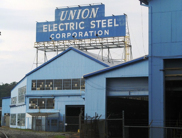
Telltale scraps, in the weeds around the tracks . . . Passing through the industrial corridor
Paw of industry (scooping up the light)
Herron Ave. Station (nr. Liberty Ave. & 33rd St.) . . . Next stop: Downtown
Satellite Map (Imagery ©2013 DigitalGlobe, Sanborn, U.S. Geol. Survey, USDA Farm Svc. Agency; Map data ©2013 Google) . . .
Street View (©2013 Google)


.JPG)


.JPG)